Stormy outlook
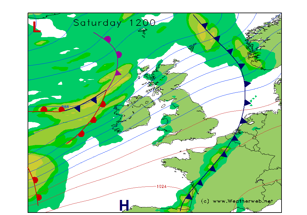
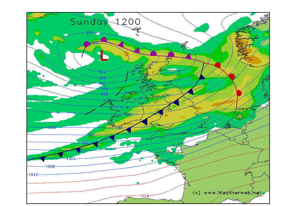
The forecast for the weekend is not one for the faint hearted. There's not a whole lot that's going to change with the overall story I must say. There may subtle variations in the absolute peak wind and timing of frontal bands, but it looks very unlikely there will be a genuinely 'good' period to be on the hills.
It should probably tell you all you need to know that there are already official weather warnings in force, and the storm has been named by the Met Office for its likely impact on the lowlands of Britain. For the mountains, everything is cranked up a good few notches to bring downright dangerous conditions.
Don't cherry pick forecasts from weather apps to find one you like. They will change every time the computers churn out the code. The bottom line is severe conditions on the mountains, with wind, rain and snow on the agenda. Hurricane-force winds on the mountains.
Things essentially go downhill through Saturday, and continue on through Sunday with widespread stormy winds. At present, the very worst of Sunday's mountain winds are focused on England & Wales, but that could easily shift further north. Gusts over 90-100mph on higher tops are to be expected.
Check your latest details updated daily here on the MWIS website, but I'd already be considering other plans this weekend. The mountains will still be there next week.
Mountain Rescue certainly won't thank you if you get into trouble this weekend.
Stay safe, stay smart..