Rain-a-gedon: Why have the Highlands been so cold and wet?
If you’ve been in the Scottish Highlands recently you’ve probably noticed that the past week, the first week of June 2024, has been unseasonably cold, snowy on high ground and with frequent very heavy showers. Many of these heavy showers are continuing through the night and into the morning. A number of people have asked me why this is and one of my friends called one of the recent downpours on Skye ‘rain-a-gedon’.
Snow and commemorative beacon on Ben Nevis on the 80th Anniversary of D-Day, 6 June 2024. Credit: Richard Payne, Walking with the Wounded
The big picture: Arctic air
The answer, of course, is in the bigger picture of where the high and low pressure systems are and where our air is coming from. The past week has been dominated by a blocking high over the Atlantic. If this was over the UK instead we’d likely be in heat wave conditions. This high is blocking our standard westerlies and is pulling in air from the Arctic instead. Much of our recent air has been coming from the high Arctic, near Svalbard. This is a summer version of the Arctic Maritime air mass.
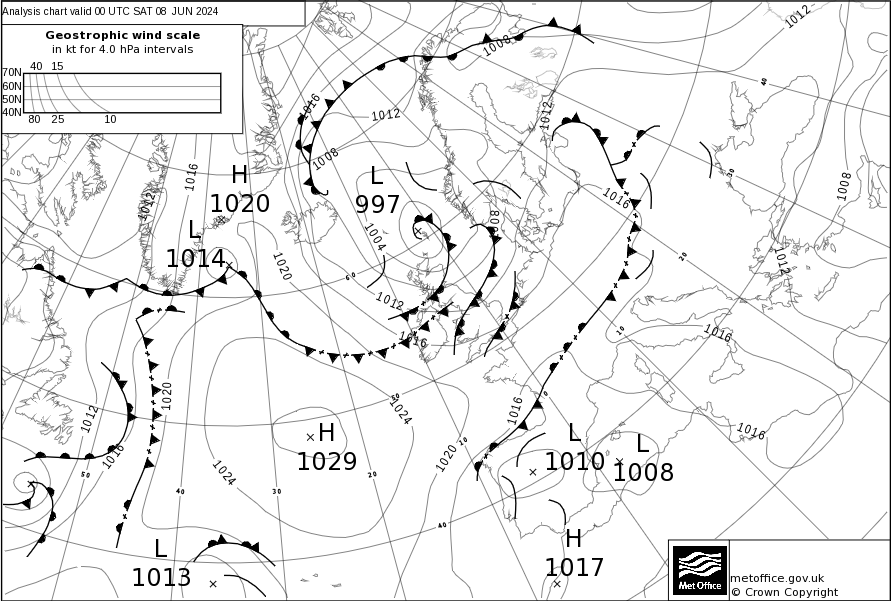
Surface pressure analysis chart for 7th June 2024, showing blocking high over the Atlantic and northwesterly airflow from the Arctic. Credit: Met Office
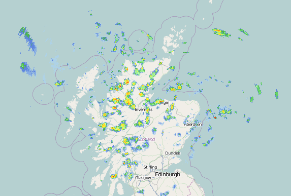
Rain radar showing heavy showers over the Highlands on the morning of 7th June 2024. These showers are moving from the north west to the south east. Credit: Net Weather
Thermals over sea and land
As we near the solstice, the sun is about as strong as it gets for the UK so it heats the land up very quickly. The power from the sun heating the land and our long hours of daylight this time of year injects extra heat into the system and invigorates the showers further once they are over land.
Combined, these processes create powerful thermals which develop into thick ('deep' in weather-speak) clouds. The darker a cloud looks from the bottom, the deeper it is. Deep clouds produce heavy precipitation and sometimes lightning. As any precipitation is falling through very cold Arctic air, it falls as snow at the highest levels and perhaps even as sleet down to near the sea, as happened in Fort William today.
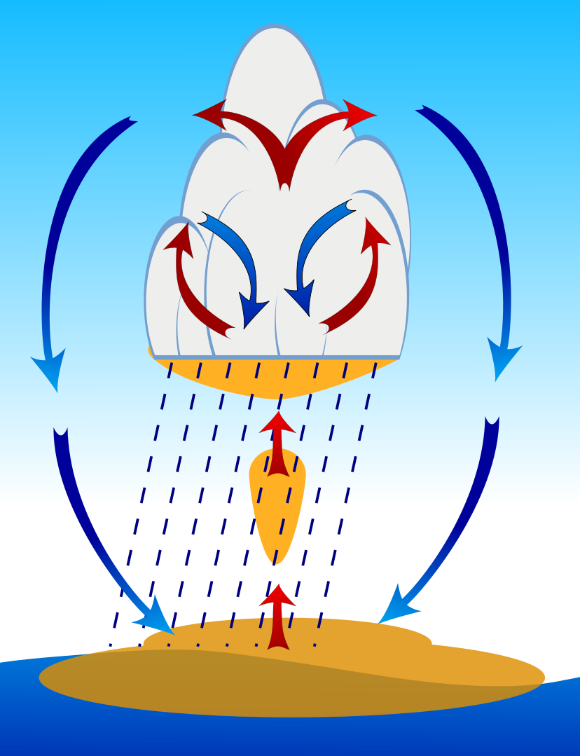
Thermals over the sea
Cold air over a relatively
warm-for-the-air-temperature sea produces convection over the sea. A typical winter-time pattern, but with cold Arctic air this can happen near the solstice too.
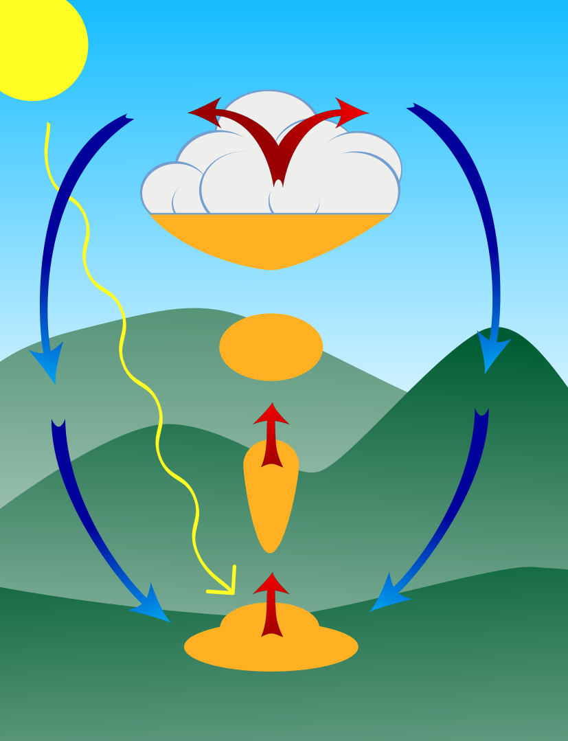
Thermals over the land
The hot sun near the solstice and long day light hours give plenty of time for the sun to inject warmth into the system. This invigorates showers coming in off the sea, resulting in particularly heavy precipitation.
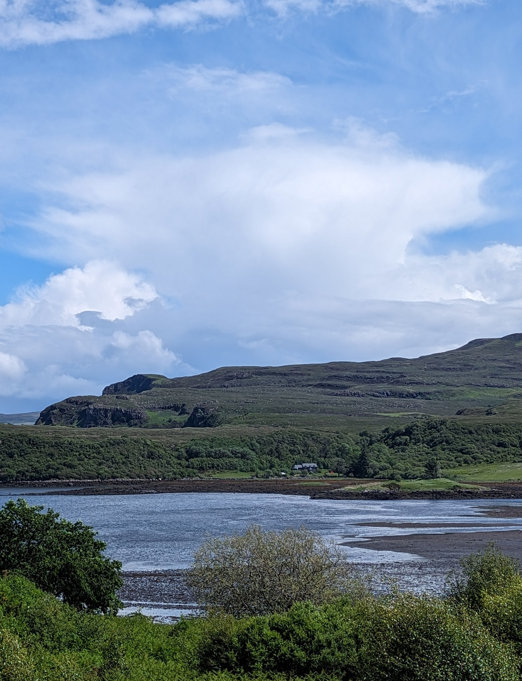
Heavy shower cloud west of Portree on Skye
Frequent heavy shower have been the theme of the week on Skye and throughout the Highlands for the first week of June 2024. This is one of the many recent shower clouds over Portree, from 4th June 2024.
Snow is aided by the fact that the arctic air, away from the thermals and clouds, is very dry. In these conditions snow can penetrate a few hundred metres below the freezing level. As the snow falls in cool, dry air it sublimes (‘evaporates’ from ice to vapour) into the atmosphere, cooling the atmosphere immediately around the snowflake which protects the rest of the snowflake from melting. You’ve possibly noticed that the air temperature can drop be a few degrees after a heavy shower; this is why. Of course, on the highest ground such as Ben Nevis the summits have been below freezing at times over the past week, helping with snow accumulation.
These processes, especially at this time of year, can be very lively which is why the showers are frequent and heavy but with sunny spells in between. The sunny spells are laying the foundation for the next shower.
MWIS Wild Weekend
Meet some of the MWIS team and ask us all your weather questions. Half of the Wild Weekend will be spent on the hill, giving us plenty of time to chat over all your questions and observe the mountain weather on the day.