As springtime arrived and our good weather streak broke down into more unsettled conditions, readers may have noticed the phrase “low confidence” in our forecasts. It is our duty to provide accurate and reliable forecasts, but sometimes our ability to do so is limited, so let’s pick apart what we really mean when we say, “low confidence” or “detail uncertain.”
The primary driver of our forecasts is model data, from which we apply our understanding of mountain microclimatology and historical experience to provide a forecast. We review output from several models for numerous variables (temperature, rainfall, etc.). All models are constructed slightly differently but often produce similar results. At times, model results can be quite different. Springtime is notorious for model disagreement as they each wrestle with how the atmosphere will change with the season.
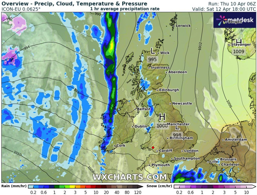
Consider the three images below, which are precipitation outputs from three different models. The model data were produced the morning of April 9, and the images represent the precipitation forecast for 6pm on April 12, which we were using for our 3-day forecast at the time.
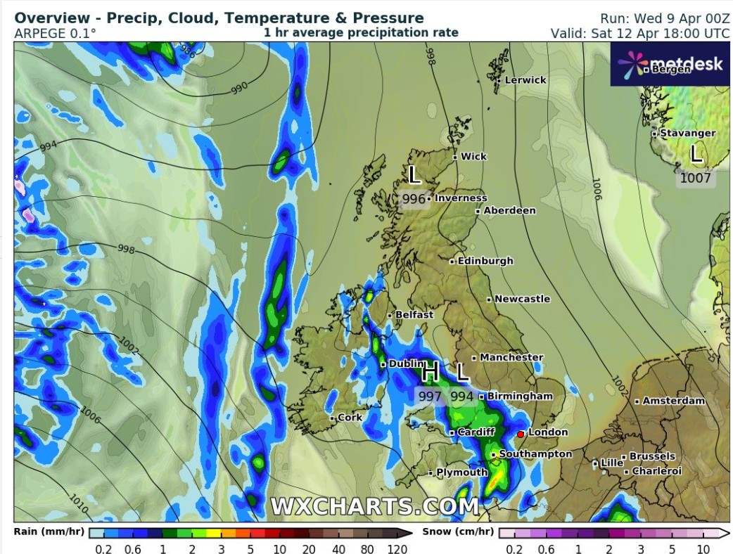
ARPEGE Model Results - April 9
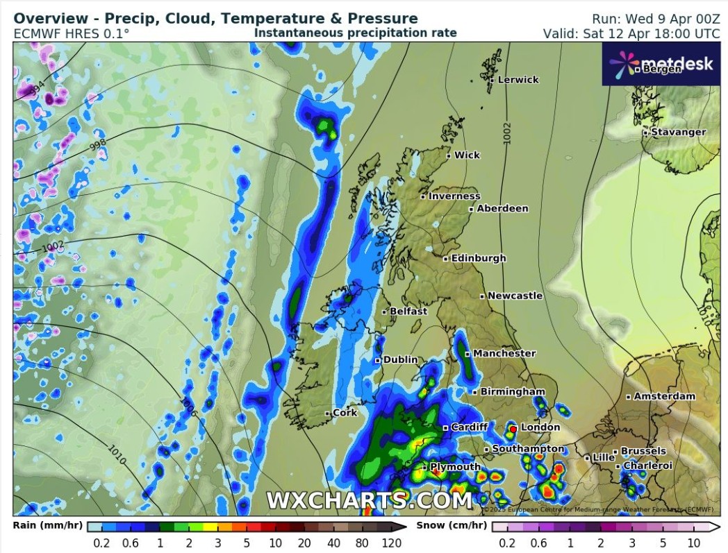
ECMWF Model Results - April 9
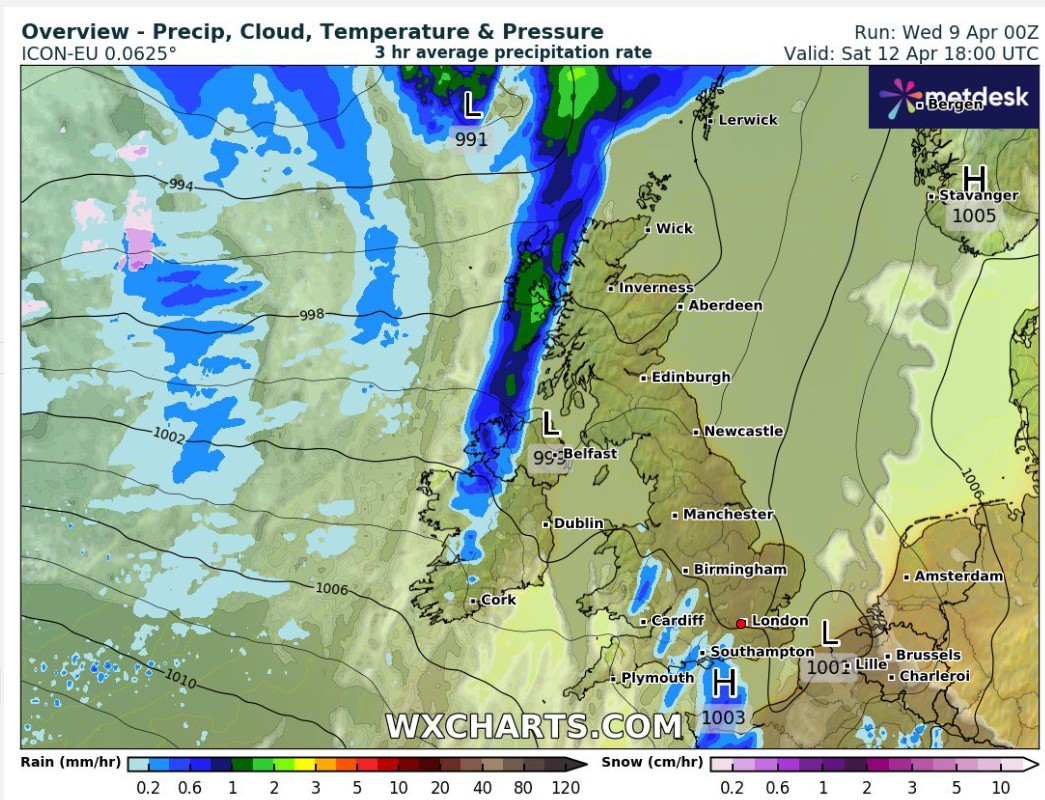
ICON Model Results - April 9
Two key weather features are observable in these model outputs: a north-south band of rain west of the British Isles, and an amebous patch of rain in the southwest (not as apparent in the ICON model). We have confidence in the existence of these features. However, we are not confident in the location and structure of the features, which challenges interpretability. Considering the inter-model variability, it would be appropriate to say that the precipitation forecast in western areas is low confidence for three days out.
The three images below show the model runs from the next morning (April 10) for the same time (6pm April 12, now a 2-day forecast).
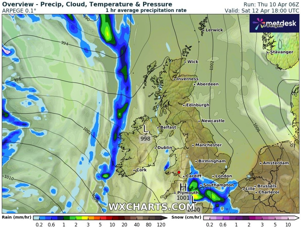
ARPEGE Model Results - April 10
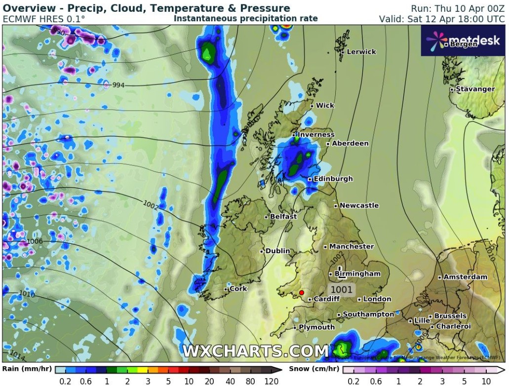
ECMWF Model Results - April 10
ICON Model Results - April 10
The north-south precipitation band seems more certain in position, though it has been pushed west and unlikely to affect the mountain forecast during the daylight hours. But what about that amebous feature in the southwest? Nearly gone! Only the ARPEGE model pushes it near Wales, and just barely. With such major changes between days and still disagreement between models, while we do warn of the possibility of precipitation in the west, it is appropriate to warn the reader that it is a low confidence forecast.
Fortunately, the quality of input data and sophistication of models is such that low confidence forecasts are the exception and not the rule. Unfortunately, some atmospheric situations are difficult for models to handle, and while we may use our experience to best interpret the results, we must be forthcoming when confidence in the forecast is low.
That's the weather story...for now!
-Dan
Screenshots of model data derived from wxcharts.com by MetDesk