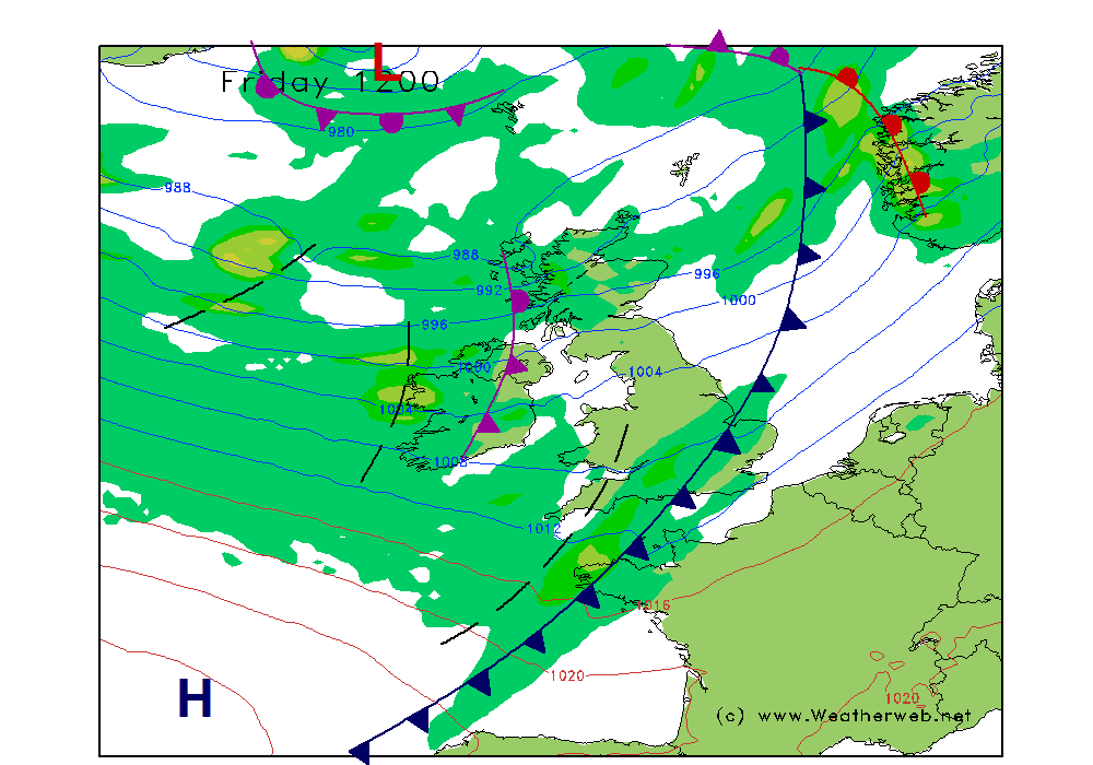
A surge of cold air will move in from the west as we head into Friday. This initially arrives behind a cold front which will bring heavy rain early on Friday. Behind the front, an unstable showery polar maritime air mass follows. The chilly air has origins from southern Greenland, and is a classic piece of Atlantic meteorology in action!
Heavy showers will be the order of the day, with hail and thunder possible. The air itself will be relatively 'dry', so there will be cloud breaks and sunshine too, with some areas faring well for a bright day. However, some places will see showers cluster together for periods. The relative dryness of the air will aid the chance for snowflakes to fall to lower hill slopes at times.
The instability factor increases through the day as we see a marked upper level trough in the atmosphere advance east across Britain. This creates an enhanced temperature contrast between the surface and higher elevations in the atmosphere - we refer to this as the 'lapse rate' - allowing clouds to grow into the cumulonimbus variety, capable of thunder.
The technical forecast charts below show the temperature at 500mb (5.5km). Notice how the tongue of colder air passes eastwards during the daytime. The 528 line also makes a brief passage across Britain, highlighting the coldness of the air. Some of the most lively showers are likely to be later in the afternoon, or even onward into the evening.
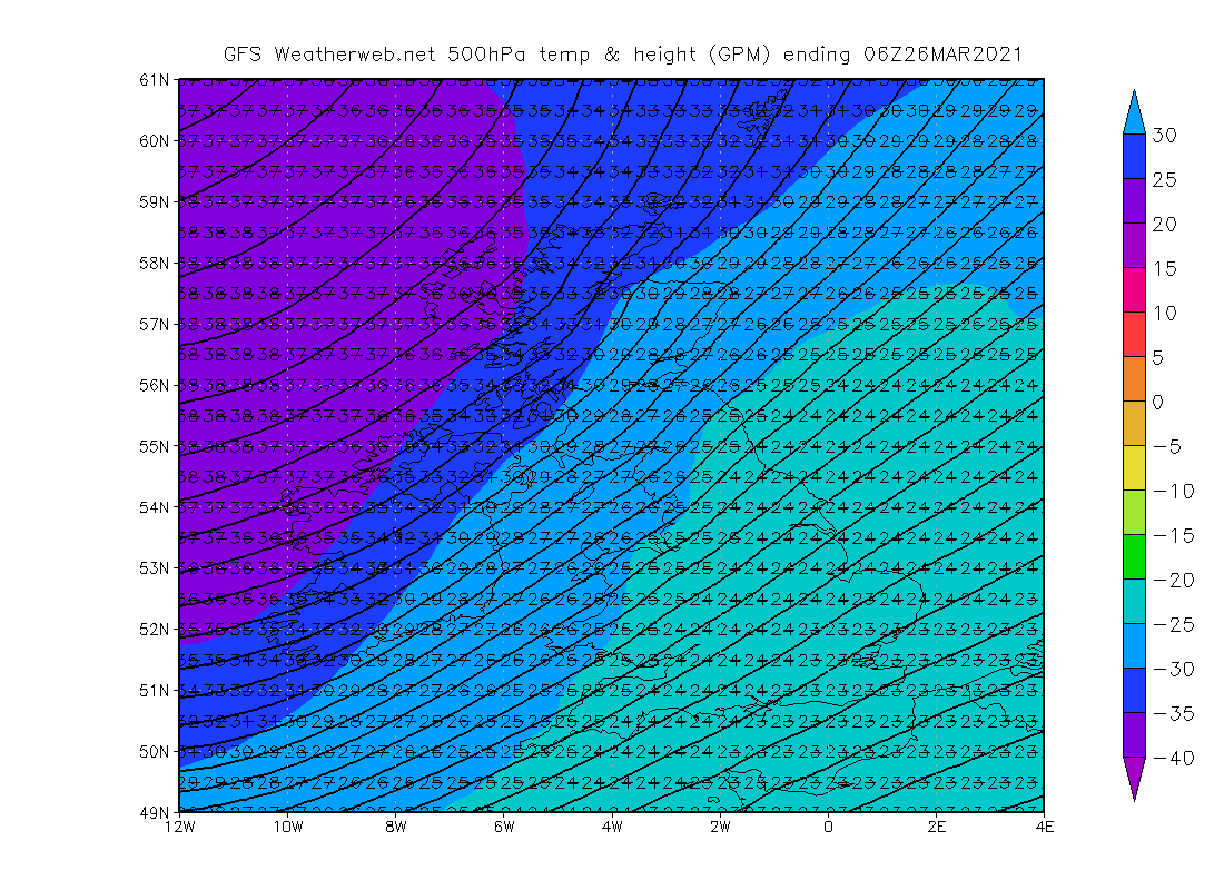
6am Friday
A cold front passing eastwards, introduces chilly air across Britain, but the coldest air higher up in the atmosphere lies to our west.
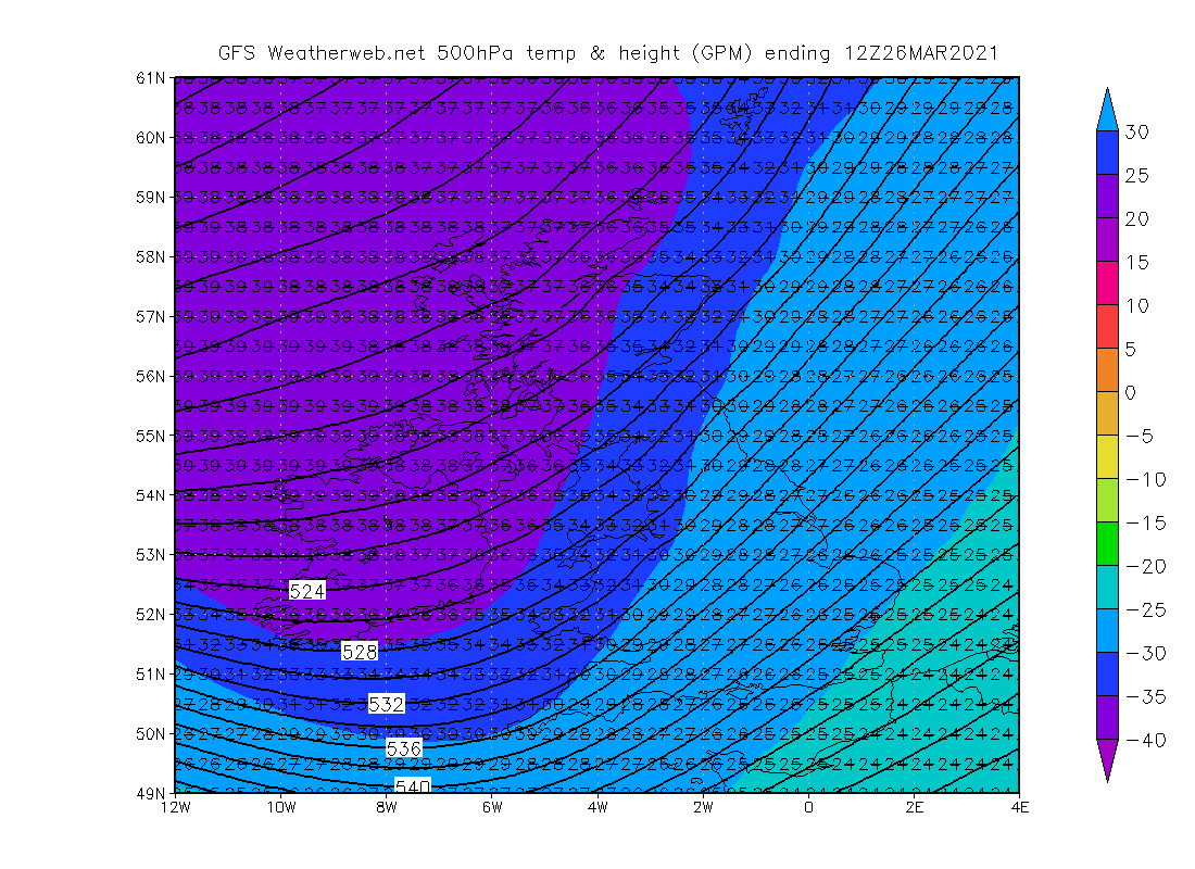
Noon Friday
The upper level trough of cold air swings across Ireland into Scotland, creating added instability to trigger showers with hail.
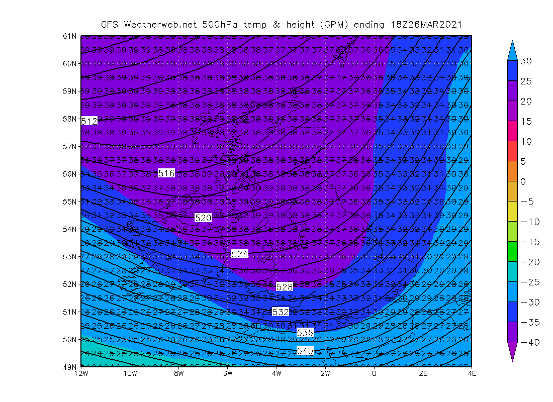
6pm Friday
A sharp upper trough advances further east. The steepest lapse rates will exist in the south, where the greatest risk of thunder exists.
The trough will pass eastwards into Saturday, taking away the unstable conditions, but it will be a gradual process to lift the temperatures, which will be sub-zero on most mountains well onward into the afternoon.
We are just about reaching the time of year where daytime thermals start to become strong enough to trigger shower development over the land under the correct atmospheric conditions. We're also still seeing 'wintertime' shower processes too - that is when the relatively warm seas around Britain aid the formation of showers over the ocean, which then run onshore on the prevailing wind.
A classic springtime 'April showers' pattern is to see showers near coasts in the morning, then these clear before midday, but showers then form increasingly in inland areas by afternoon. Watch for that in the weeks ahead on showery days!